Union Terminal – Airport Express Shuttle
With intercity rail plans such as the Midwest Hub high-speed rail system, the 3-C Corridor, and rail links from Cincinnati to Lexington and Louisville under development, Cincinnati’s landmark Union Terminal has the potential to see its role restored as a regional rail hub and gateway to the city. In addition, a fast, convenient rapid transit link between Union Terminal and Greater Cincinnati – Northern Kentucky Airport (CVG) would allow regional trains to operate as feeders for long-distance air travel and turn Cincinnati into a major regional transportation hub.
The Silver Line is planned to fulfill this role, serving as an express shuttle between Union Terminal and the airport. Plans are currently underway to replace the Brent Spence Bridge, which carries Interstates 71 and 75 over the Ohio River at Cincinnati. This river crossing is the most direct route between Union Terminal and the airport, and incorporating a rapid transit right-of-way into the new span would allow this rail shuttle service to be possible. With the exception of the river crossing, the Silver Line operates entirely on rights-of-way shared by other transit lines in this proposal.
The Silver Line is approximately 12.2 miles long, and serves four stations.
Route Map
| Union Terminal | ||||
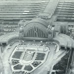
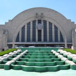
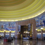
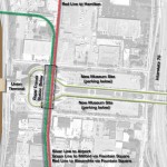
| Intercity Rail Hub Cincinnati Museum Center 1301 Western Avenue, Cincinnati, Ohio This is a subway station with two island platforms, located below Dalton Street where it passes under Ezzard Charles Drive. One platform serves Silver Line trains; other platform serves Red Line and Green Line trains. The station has direct indoor access to Union Terminal via escalators and an underground concourse. Connections to taxi, bus, and streetcar service at Union Terminal are also available. Silver Line trains leave the station via an underground tunnel running southbound below Dalton Street, and emerge onto an elevated viaduct and turn east as they approach the Queensgate station and the Brent Spence Bridge. |
||||
| Queensgate | ||||
| Dalton Street and Linn Street, Cincinnati, Ohio
The Queensgate neighborhood of Cincinnati is immediately to the west of downtown, and consists primarily of light industrial and warehouse uses. Queensgate is currently separated from downtown by the sprawling I71/75 expressway interchange and approach ramps to the Brent Spence Bridge. With plans underway to replace the bridge and highway interchange, however, this neighborhood could potentially be reconnected to downtown and see large-scale future development. This station consists of two elevated island platforms serving Silver Line and Blue Line, and one subway island platform serving Red Line and Green Line. The above-ground and below-ground portions of the station share a common station house at street level. Upon departing this station, Silver Line trains turn south and cross the Ohio River via the new Brent Spence Bridge. |
||||
| Ohio River Crossing via new Brent Spence Bridge |
||||
| After crossing the river, trains run on dedicated express tracks in the median of Interstate 71/75, heading roughly southwest toward the airport. The express tracks are shared by the Gold Line, and bypass the 12th Street and Fort Wright stations. Orange Line trains run on separate tracks along the same right-of-way, but make all local stops. | ||||
| Fort Mitchell | ||||
| Interstate 71/75 and Buttermilk Pike, Fort Mitchell, Kentucky
This station consists of two island platforms in the Interstate 71/75 expressway median at the Buttermilk Pike interchange. One platform serves all outbound trains; other platform serves all inbound trains. Silver Line and Gold Line trains operate on outer express tracks; Orange Line trains operate on inner local tracks. This is the final station before the Silver Line and Gold Line split from the Orange Line and head west toward the airport. Orange Line trains continue southwest to Florence. This station would be a major hub for local bus routes, and include a large parking garage for Park-and-Ride commuter service. Upon leaving this station, Silver Line and Gold Line trains branch to the west along Interstate 275, running in the median of I-275 for approximately three miles before going into a subway tunnel between Mineola Pike and Point Pleasant Road. The tunnel enters the airport property in the vicinity of Point Pleasant Road and Commonwealth Avenue, runs under the northern end of the east runway, and heads west toward Terminal Drive. |
||||
| International Airport | ||||
| Greater Cincinnati – Northern Kentucky International Airport Terminal Drive at Terminal 3, Boone County, Kentucky This is a subway station with two island platforms, located below Terminal Drive in front of Terminal 3, the airport’s newest and largest terminal. One platform serves Silver Line trains; other platform serves Gold Line. Direct indoor connection to lower level of Terminal 3 and parking garage. Direct indoor access is provided to the lower level of Terminal 3 and to the Terminal 3 parking garage via an underground concourse. Above-ground walkways currently provide access between Terminal 3 and the other two terminal facilities at the airport. The station is designed so that a future westward extension of the transit line can be achieved with minimal disruption. |
Notes / Image Credits
- Jack Klumpe, Eyewitness on Cincinnati (Cincinnati: The Cincinnati Post, 1985), 13.


