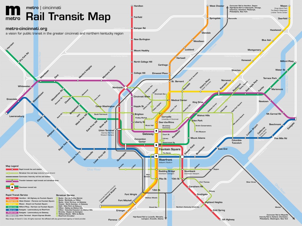
The Metro Cincinnati transit plan envisions a three-tiered system of rail transit: a heavy-rail rapid transit system comparable in nature to the Washington Metro subway system, a network of surface-running streetcar lines such as that currently being proposed to link the downtown and Uptown neighborhoods, and commuter rail service to nearby cities. Rapid transit provides fast travel times over longer distances on a fully grade-separated right-of-way, while the streetcars serve as circulators within neighborhoods and as feeders to rapid transit lines. Commuter and intercity rail operates on existing mainline railroad tracks, and provides service between Union Terminal and a number of other cities within the region.
Rapid Transit Routes
With the exception of the Silver Line (an express shuttle between Union Terminal and the airport) each rapid transit line provides direct access to the downtown business district and at least one transfer point to every other line. It is therefore possible to travel from one station to any other station with a maximum of one transfer. Station names generally reflect the name of the neighborhood or locale they serve, and are kept as concise as possible. No two stations on the rapid transit system share the same name, avoiding confusion for customers seeking directions. (The Chicago ‘L’ system, by contrast, has five stations named “Western”, three of them on the same line.)
The rapid transit lines are color-coded as follows:
- Warm colors (Red, Orange, Gold) apply to routes that generally travel in a north-south direction.
- Cool colors (Green, Blue, Purple) apply to routes that generally travel in an east-west direction.
- Precious metal colors (Silver and Gold) apply to routes that provide service between downtown, Union Terminal, and the Greater Cincinnati – Northern Kentucky International Airport.
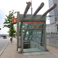
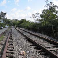
To the greatest extent possible, routes were chosen that utilize existing transit infrastructure and rights-of-way. Such infrastructure includes Union Terminal, the abandoned Central Parkway Subway, Riverfront Transit Center, the Oasis Line, the L&N Bridge, and Government Square.
 |
 |
 |
 |
 |
 |
Click on an image below for a higher-resolution version.
Route Planning
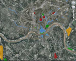
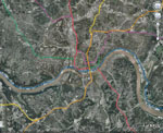
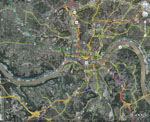
Google Earth was used to map business districts, attractions, existing transit corridors, proposed transit lines, and station locations.
Diagram Map
Use of a diagram map rather than a geographic map is common tool for wayfinding on rail transit systems, dating to the London Underground map designed by Henry Beck in 1931. Rather than showing a geographically-accurate map to scale, the diagram shows the relationship between the routes and stations that can be easily understood by the public. Common features of transit diagram maps include evenly-spaced stations, color-coded lines, and routes shown at 45-degree angles.
 Click on the image below for a full-scale version.
Route Descriptions
Each line of the Metro Cincinnati system is described in further detail on its own page:
The Red Line runs north-south from Hamilton to Alexandria, via Fifth Street and the Fountain Square transit hub. This route provides service to Cincinnati State University, Union Terminal, US Bank Arena, downtown Newport, and Northern Kentucky University.
The Orange Line runs north-south from West Chester to Florence, via Vine Street and the Fountain Square transit hub. This line provides service to the Cincinnati Zoo and Botanical Gardens, the University Medical District, the University of Cincinnati, Over-the-Rhine, Paul Brown Stadium, the Great American Ballpark, and downtown Covington.
The Gold Line runs north-south from Mason to the Greater Cincinnati – Northern Kentucky International Airport, via Vine Street and the Fountain Square transit hub. Between the King Drive and Fort Mitchell stations, this line parallels the Orange Line and runs express, making limited stops. This line serves the Kings Island theme park, Xavier University, the University Medical District, the University of Cincinnati, Paul Brown Stadium, the Great American Ballpark, downtown Covington, and the International Airport.
The Green Line runs east-west from Milford to Harrison, via Fifth Street and the Fountain Square transit hub. This line serves Mariemont, Eden Park, Mount Adams, Broadway Commons, Union Terminal, and the Western Hills neighborhoods.
The Blue Line runs east-west along the river from Eastgate to Lawrenceburg, via Second Street and the Riverfront Transit Center. This line serves the River Downs race track, Riverbend Music Center, Coney Island, Lunken Airport, US Bank Arena, the Great American Ballpark, Paul Brown Stadium, Anderson Ferry, and the Hollywood Casino in Lawrenceburg.
The Purple Line runs east-west from Eastgate to Lawrenceburg via Central Parkway, following a more inland route than the Blue Line. This line serves Hyde Park, Over-the-Rhine, Findlay Market, Cincinnati State University, and the Hollywood Casino in Lawrenceburg.
The Silver Line is an express shuttle serving Union Terminal and the Greater Cincinnati – Northern Kentucky International Airport, allowing regional high-speed rail service to act as a feeder for long-distance air travel.
The Cincinnati Streetcar is a transit system currently under development by the City of Cincinnati. Phase One of the streetcar runs between the downtown riverfront and the Cincinnati Zoo and Botanical Gardens, serving Fountain Square, Over-the-Rhine, Music Hall, Findlay Market, the University of Cincinnati, and the University Medical District. Future phases of the streetcar system have the potential to serve as neighborhood circulators and as feeders into the rapid transit system.

