Milford – Harrison via Fountain Square
The Green Line is an east-west rapid transit line that runs from Milford, Ohio to Harrison, Ohio near the Indiana border, via Fountain Square. This line provides direct service to the historic Village of Mariemont, fashionable Mount Adams, Union Terminal, and the residential neighborhoods and suburbs west of the city.
The line is approximately 36.8 miles long, with 22 stations.
Route Map
Notes / Image Credits
- Jack Klumpe, Eyewitness on Cincinnati (Cincinnati: The Cincinnati Post, 1985), 13.
| Milford | ||||||
| Wooster Pike at Glendale Milford Road, Milford, Ohio
The Milford station consists of an island platform with two tracks on an elevated railroad embankment, with fare control in a station house at ground level. The station is located on the west bank of the Little Miami River, across a short bridge from Milford’s historic downtown business district. Leaving the station, Green Line trains continue southwest along an abandoned railroad right-of-way that roughly parallels Wooster Pike (US 50). |
||||||
| Terrace Park | ||||||
| 982 Wooster Pike, Terrace Park, Ohio
This station consists of two side platforms on an elevated embankment, with fare control in a station house at ground level. A Park & Ride facility is available.
Trains continue southwest on the former railroad right-of-way alongside Wooster Pike. As the line approaches the historic Mariemont business district, the right-of-way transitions into a subway tunnel running under Wooster Pike. |
||||||
| Mariemont | ||||||
| Wooster Pike at Miami Road, Mariemont, Ohio
At this station, the inbound and outbound tracks split, following the respective inbound and outbound lanes of Wooster Pike through the Mariemont town square. The station consists of side platforms in two separate tunnels, connected by a common fare control area between the inbound and outbound platforms. Stairs, escalators, and an elevator provide access to street level. The station entrance is in an area of the town square currently occupied by parking, with a kiosk structure designed to be visually compatible with the Tudor Revival character of the historic planned community. Leaving the station, trains continue southwest in a subway under Wooster Pike. As Wooster Pike becomes Columbia Parkway, the subway right-of-way branches off and follows Wooster Road before transitioning to an above-ground alignment following the abandoned Wasson railroad right-of-way and joining the Purple Line tracks. |
||||||
| Fairfax | ||||||
| Columbia Parkway and Red Bank Road, Cincinnati, Ohio
This is an elevated station with side platforms. Fare control is in a station house at ground level. Traveling west, trains cross a long viaduct before heading through Ault Park on the currently-abandoned Wasson rail line. Trains travel at grade until reaching Paxton Road, at which point they ascend onto an elevated viaduct running alongside Wasson Road. |
||||||
| Hyde Park | ||||||
| Wasson Road at Edwards Road, Cincinnati, Ohio
This is an elevated station with side platforms. Fare control is in a station house at ground level. Leaving the station westbound, trains descend to grade level and continue along the Wasson line, crossing Interstate 71. West of I-71, the Orange Line joins the Purple and Green Line right-of-way but remains on separate tracks. Purple, Green, and Orange Line trains descend into an open cut before entering the next station. |
||||||
| Evanston | ||||||
| 3722 Montgomery Road, Cincinnati, Ohio
This station serves as a transit hub and transfer point between the Purple Line, Green Line, and Gold Line. The station consists of two island platforms with four tracks, located in an open cut north of Dana Avenue. Fare control is on a mezzanine level at grade. West of this station, Purple and Green Line trains turn south, and descend into a subway at Victory Parkway, and continue southwest under Gilbert Avenue. Gold Line trains continue west, descending into a subway under Dana Avenue. |
||||||
| Walnut Hills | ||||||
| Gilbert Avenue at East McMillan Street, Cincinnati, Ohio
The Walnut Hills station is an underground station with side platforms, and fare control located on mezzanines at either end. The north mezzanine provides access to and from William Howard Taft Drive; the south mezzanine opens to East McMillan Street. Street access is via sidewalk kiosks and elevators. |
||||||
| Eden Park | ||||||
| Gilbert Avenue at Eden Park Drive, Cincinnati, Ohio
This is an underground station with side platforms. Fare control is on a mezzanine above the platforms. Street access is via sidewalk kiosks and elevators. Southwest of this station, Purple Line trains pass under Interstate 71 and travel in a subway under Reading Road, while Green Line trains continue south into a deep tunnel under Mount Adams. |
||||||
| Mount Adams | ||||||
| 1048 St. Gregory Street, Cincinnati, Ohio
The Mount Adams station features side platforms in a deep-bore station located approximately 300 feet below the intersection of Pavilion Street and St. Gregory Street in Cincinnati’s unique Mount Adams neighborhood. Access to the station is via a bank of four high-speed elevators to street level, with fare control located on a mezzanine above the platforms. The elevators ascend to a station house located on St. Gregory Street, currently the site of a small parking lot. This is the only station in the Metro system where access to the station is soley by elevator. Leaving the station, Green Line trains pass under the Interstate 71/471 interchange before joining the Red Line and continuing west under Fifth Street toward Fountain Square. |
||||||
| Fountain Square | ||||||
| West Fifth Street and Vine Street, Cincinnati, Ohio
Fountain Square is the primary transit hub of the Metro system, located in the heart of downtown Cincinnati. Red Line and Green Line trains travel in a subway running east-west under Fifth Street, while Gold Line and Orange Line trains travel in a subway running north-south under Vine Street. Fountain Square is located where the Vine Street subway passes under the Fifth Street subway, with fare control located on a large mezzanine between the two levels. This mezzanine is located within the shell of the Fountain Square parking garage, with entrances to the station located on Vine Street and Walnut Street, at the former vehicle entrances to the parking garage. The Fountain Square transit hub is discussed in further detail on its own page. Leaving Fountain Square station, Red Line and Green Line trains travel west under Fifth Street, passing under Interstate 75. |
||||||
| Queensgate | ||||||
| Dalton Street and Linn Street, Cincinnati, OH
The Queensgate neighborhood of Cincinnati is immediately to the west of downtown, and consists primarily of light industrial and warehouse uses. Queensgate is currently separated from downtown by the sprawling I-71/75 expressway interchange and approach ramps to the Brent Spence Bridge. With plans underway to replace the bridge and highway interchange, however, this neighborhood could potentially be reconnected to downtown and see large-scale future development. This station consists of two elevated island platforms serving Silver Line and Blue Line, and one subway island platform serving Red Line and Green Line. The above-ground and below-ground portions of the station share a common station house at street level. Upon departing this station, Red Line and Green Line trains turn northward and head toward Union Terminal via Dalton Street. |
||||||
| Union Terminal | ||||||
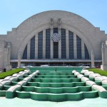
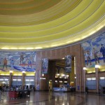
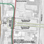
| Intercity Rail Hub Cincinnati Museum Center 1301 Western Avenue, Cincinnati, OH This is a subway station with two island platforms, located below Dalton Street where it passes under Ezzard Charles Drive. One platform serves Silver Line trains; other platform serves Red Line and Green Line trains. The station has direct indoor access to Union Terminal via escalators and an underground concourse. Connections to taxi, bus, and streetcar service at Union Terminal are also available. Green Line trains leave the station via an underground tunnel running northbound below Dalton Street. North of Union Terminal, the Green Line diverges from the Red Line, turning west and passing under a large freight rail yard and Mill Creek as it approaches Glenway Avenue. For the next five stations, the Green Line runs in a deep-bore subway under Glenway Avenue. |
||||||
| State Avenue | ||||||
| State Avenue and Mistletoe Avenue, Cincinnati, Ohio
This station is a deep-bore subway station with an island platform, and fare control located on a mezzanine above. Access to the street level is via escalators and an elevator to a pavilion at ground level. |
||||||
| East Prince Hill | ||||||
| Glenway Avenue at Quebec Road, Cincinnati, Ohio
This station is a deep-bore subway station with an island platform, and fare control located on a mezzanine above. Access to the street level is via escalators and an elevator to a pavilion at ground level. |
||||||
| West Price Hill | ||||||
| Glenway Avenue at Cleves Warsaw Pike, Cincinnati, Ohio
This station is a deep-bore subway station with an island platform, and fare control located on a mezzanine above. Access to the street level is via escalators and an elevator to a pavilion at ground level.
|
||||||
| Bridgetown | ||||||
| Glenway Avenue at Werk Road, Cincinnati, Ohio
This station is a deep-bore subway station with an island platform, and fare control located on a mezzanine above. Access to the street level is via escalators and an elevator to a pavilion at ground level. |
||||||
| Cheviot | ||||||
| Glenway Avenue and Bridgetown Road, Cincinnati, Ohio
This station is a deep-bore subway station with an island platform, and fare control located on a mezzanine above. Access to the street level is via escalators and an elevator to a pavilion at ground level. Northwest of the Cheviot station, the Green Line emerges onto the former C&O Railroad right-of-way, which roughly parallels Harrison Avenue. Approaching Wesselman Road, the Green Line departs the railroad right-of-way, turns north, and ascends onto an elevated viaduct. |
||||||
| Wesselman Road | ||||||
| 6106 Wesselman Road, Green Township, Ohio
The Wesselman Road station is on an elevated viaduct with side platforms. Fare control is located in a station house at street level. A Park & Ride facility is provided at this station. Leaving this station, the Green Line viaduct continues alongside Harrison Avenue until reaching the Interstate 74 interchange, where it joins the Purple Line in the median of the expressway. |
||||||
| Dent | ||||||
| Interstate 74 at Harrison Avenue, Dent, Ohio
This station consists of an island platform in the median of Interstate 74, with fare control located in a station house on Harrison Avenue. A Park & Ride facility is also provided. |
||||||
| Miamitown | ||||||
| Interstate 74 at Hamilton Cleves Road, Miamitown, Ohio
This station consists of an island platform in the median of Interstate 74, with fare control located in a station house on Hamilton Cleves Road. A Park & Ride facility is also provided. West of this station, the Purple Line diverges and follows Interstate 275, as the Green Line continues along the Interstate 74 right-of-way. |
||||||
| Dry Fork Road | ||||||
| Interstate 74 at Dry Fork Road, Harrison, Ohio
This station consists of an island platform in the median of Interstate 74, with fare control located in a station house on Dry Fork Road. A Park & Ride facility is also provided. In the vicinity of New Haven Road, the Green Line descends into a subway tunnel and travels under Harrison Avenue for the final mile of the route. |
||||||
| Harrison | ||||||
| Harrison Avenue at Walnut Street, Harrison, Ohio
This station is located in the historic Harrison business district, and consists of an island platform with fare control located on a mezzanine above. Access to the street is via sidewalk kiosks. |


