Hamilton – Alexandria via Fountain Square
The Red Line is a rapid transit line running roughly north-south from the city of Hamilton, Ohio to Alexandria, Kentucky via Fifth Street in downtown Cincinnati. This line serves Cincinnati State University, the Museum Center and proposed intercity rail hub at Union Terminal, the primary rapid transit hub at Fountain Square, Cincinnati’s riverfront park system at Sawyer Point, the Newport on the Levee shopping and entertainment complex, and Northern Kentucky University. The Red Line utilizes a portion of Cincinnati’s existing subway tunnels between the Hopple Street and Brighton Corner stations.
The Red Line is approximately 31.6 miles long, and serves 20 stations.
Route Map
| Hamilton | ||||||||
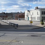
| North 5th Street and High Street, Hamilton, OhioThe northern Red Line terminal is located in downtown Hamilton, north of High Street between Martin Luther King Jr. Boulevard and the existing railroad tracks. The station site is currently a large surface parking lot. This above-ground station consists of a center island platform with fare control located at ground level, and a rail yard and maintenance facility for Red Line trains would be located in the vicinity.
Leaving the Hamilton station, Red Line trains head south on an elevated viaduct that parallels the existing railroad tracks until crossing Dixie Highway, at which point the viaduct travels above or alongside Pleasant Avenue. |
||||||||
| Fairfield | ||||||||
| Pleasant Avenue at Niles Road, Fairfield, OhioThis is an above-ground station, with fare control located in a station house at ground level. Pleasant Avenue becomes Hamilton Avenue south of this station. | ||||||||
| Kemper Road | ||||||||
| Hamilton Avenue at West Kemper Road, Cincinnati, OhioThis is an above-ground station, with fare control located in a station house at ground level. | ||||||||
| New Burlington | ||||||||
| Hamilton Avenue at Springdale Road, Cincinnati, OhioThis is an above-ground station, with fare control located in a station house at ground level.
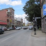
In the vicinity of Meredith Drive, the Red Line viaduct shifts a half-block to the west of Hamilton Avenue, following an alley behind buildings facing the Mouth Healthy neighborhood business district. |
||||||||
| Mount Healthy | ||||||||
| Hamilton Avenue at Compton Road, Cincinnati, OhioThis is an above-ground station, located a half-block west of the Mount Healthy neighborhood business district. Fare control is located in a station house at ground level.
South of Stevens Avenue, the Red Line viaduct shifts a half-block to the east and resumes following Hamilton Avenue, crossing the Cross-County Highway. |
||||||||
| North College Hill | ||||||||
| Hamilton Avenue at West Galbraith Road, Cincinnati, OhioThis is an above-ground station, with fare control located in a station house at ground level. | ||||||||
| College Hill | ||||||||
| Hamilton Avenue at North Bend Road, Cincinnati, OhioThis is an above-ground station, with fare control located in a station house at ground level.
The Red Line viaduct follows Hamilton Avenue through the LaBoiteaux Woods greenbelt, and then transitions into an underground subway before reaching Ashtree Drive. The subway continues south under Hamilton Avenue as it approaches the Northside neighborhood business district. In the vicinity of Chase Avenue, Purple Line tracks merge with the Red Line from the west. |
||||||||
| Northside | ||||||||
Hamilton Avenue at Blue Rock Street, Cincinnati, OhioThis is an underground station with its main entrance on the southwest corner of Hamilton Avenue and Blue Rock Street, the former Vandalia Avenue right-of-way now used as a parking lot. This station serves as a transfer point between the Red Line, Purple Line, and streetcar route B.
Leaving Northside, trains head southbound under Colerain Avenue. |
||||||||
| Camp Washington | ||||||||
| Colerain Avenue at Hopple Street, Cincinnati, OhioThis is a below-grade station, with fare control located on a mezzanine level above the platforms. The entrance to the station is on the southeast corner of Colerain and Hopple, currently the site of a gas station.
Traveling south, the tunnels shift slightly to the west and travel under Spring Grove Avenue, which becomes Dalton Street. The Green Line tracks merge with the Red Line from the west in the vicinity of Liberty Street. |
||||||||
| Union Terminal | ||||||||
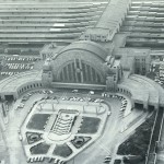
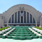
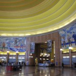
| Intercity Rail Hub Cincinnati Museum Center 1301 Western Avenue, Cincinnati, Ohio This is a subway station with an island platform and two side platforms, located below Dalton Street where it passes under Ezzard Charles Drive. The island platform serves Silver Line trains, which terminate here; the side platforms serves Red Line and Green Line trains. The station has direct indoor access to Union Terminal via escalators and an underground concourse. Connections to taxi, bus, and streetcar service at Union Terminal are also available. Red Line trains leave the station via an underground tunnel running southbound below Dalton Street, and turn east under Dalton Avenue as they approach the Queensgate station. |
||||||||
| Queensgate | ||||||||
| Dalton Street and Linn Street, Cincinnati, Ohio
The Queensgate neighborhood of Cincinnati is immediately to the west of downtown, and consists primarily of light industrial and warehouse uses. Queensgate is currently separated from downtown by the sprawling I-71/75 expressway interchange and approach ramps to the Brent Spence Bridge. With plans underway to replace the bridge and highway interchange, however, this neighborhood could potentially be reconnected to downtown and see large-scale future development. This station consists of two elevated island platforms serving Silver Line and Blue Line trains, and one subway island platform serving the Red Line and Green Line. The above-ground and below-ground portions of the station share a common station house at street level. Upon departing this station, Red Line and Green Line trains continue eastward into downtown via Fifth Street, passing under Interstate 75. |
||||||||
| Fountain Square | ||||||||
| West Fifth Street and Vine Street, Cincinnati, Ohio
Fountain Square is the primary transit hub of the Metro system, located in the heart of downtown Cincinnati. Red Line and Green Line trains travel in a subway running east-west under Fifth Street, while Gold Line and Orange Line trains travel in a subway running north-south under Vine Street. Fountain Square is located where the Vine Street subway passes under the Fifth Street subway, with fare control located on a large mezzanine between the two levels. This mezzanine is located within the shell of the Fountain Square parking garage, with entrances to the station located on Vine Street and Walnut Street, at the former vehicle entrances to the parking garage. This station also provides a transfer point to streetcar routes A, B, and C. The Fountain Square transit hub is discussed in further detail on its own page. Leaving Fountain Square station, Red Line and Green Line trains travel east under Fifth Street, passing under Interstate 71. East of I-71, the Red Line splits to the south, heading above-ground prior to crossing the Ohio River. The Green Line continues east under Mount Adams before turning northeast. |
||||||||
| Sawyer Point | ||||||||
| Newport Southbank Bridge at Pete Rose Way, Cincinnati, Ohio
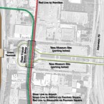
This is an above-ground station, with fare control located in a station house at ground level. The Blue Line runs roughly perpendicular to the Red Line at this station, traveling on a subway below Pete Rose Way. The ground-level station house provides access to both lines. South of this station, the Red Line utilizes the abandoned railroad right-of-way on the Newport Southbank Bridge to cross the Ohio River into Northern Kentucky. |
||||||||
| Ohio River Crossing via the Newport Southbank (formerly L&N) Bridge |
||||||||
| Newport | ||||||||
| Saratoga Street at East Third Street, Newport, Kentucky
This is the first Red Line station on the Kentucky side of the river, located immediately south of the Newport Southbank Bridge. The station is on an elevated viaduct, with fare control located in a station house at ground level facing Third Street. The station is adjacent to the Newport on the Levee shopping and entertainment complex, which includes the Newport Aquarium, and provides a transfer point to streetcar route H. Upon leaving the station, Red Line trains cross Third Street and transition to a subway running under Saratoga Street. |
||||||||
| 10th Street | ||||||||
| Saratoga Street at East Tenth Street, Newport, Kentucky
This is a subway station with fare control located on a mezzanine above the platform level. Entry to the station is via sidewalk kiosks. This station provides a transfer point to streetcar route J. South of 10th Street, the Red Line passes below a freight railroad and wooded area before continuing south under Monmouth Street. |
||||||||
| Carothers Road | ||||||||
| Monmouth Street at Carothers Road, Newport, Kentucky
This is a subway station with fare control located on a mezzanine above the platform level. Entry to the station is via a pavilion at the northeast corner of Monmouth Street and Carothers Road. Leaving the station, the Red Line continues south under Monmouth Street, which becomes Alexandria Pike. |
||||||||
| Southgate | ||||||||
| Alexandria Pike at Moock Road, Southgate, Kentucky
This is a subway station with fare control located on a mezzanine above the platform level. Entry to the station is via a ground-level entry pavilion. After leaving this station, Red Line trains turn south and emerge alongside Interstate 471. Tracks continue at grade alongside I-471 until the highway ends at Alexandria Pike in Highland Heights. At this point the tracks ascend onto an elevated viaduct running in a newly-created median separating the northbound and southbound lanes of Alexandria Pike. |
||||||||
| Highland Heights | ||||||||
| Northern Kentucky University Alexandria Pike at Nunn Drive, Highland Heights, Kentucky This is an elevated station with side platforms, with fare control in a station house located at ground level. Streetcar route J connects this station to the nearby Northern Kentucky University campus. The Highland Heights station is typical of many elevated stations throughout the Metro Cincinnati system, and is discussed in further detail on its own page. |
||||||||
| Cold Spring | ||||||||
| Alexandria Pike at East Alexandria Pike, Cold Spring, Kentucky
This is an elevated station with fare control in a station house located at ground level. |
||||||||
| Alexandria | ||||||||
| Alexandria Pike at Alexandria-Ashland Highway, Alexandria, Kentucky
This is an elevated station with an island platform, with fare control in a station house located at ground level. A rail yard and maintenance facility for Red Line trains would be located in the vicinity. |
Notes / Image Credits
- Jake Mecklenborg, “Abandoned Subway: Brighton Station Photos”, Cincinnati-Transit.net, http://www.cincinnati-transit.net/subway-brightontour3.html [accessed 25 July 2009].
- Jake Mecklenborg, “Abandoned Subway: Brighton Station Photos”, Cincinnati-Transit.net, http://www.cincinnati-transit.net/subway-brightontour2.html [accessed 25 July 2009].
- Jake Mecklenborg, “Abandoned Subway: Brighton Station Photos”, Cincinnati-Transit.net, http://www.cincinnati-transit.net/subway-brightontour1.html [accessed 25 July 2009].
- City of Cincinnati, “Cincinnati Subway Conversion Study” (PowerPoint presentation), prepared by URS Corporation, September 2008, Slide 29.
- Jack Klumpe, Eyewitness on Cincinnati (Cincinnati: The Cincinnati Post, 1985), 13.

