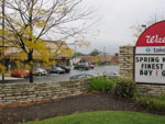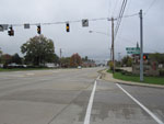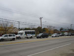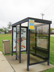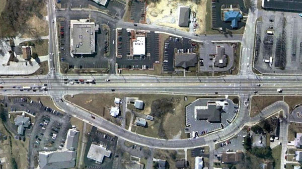
The Highland Heights Station is served by the Red Line running between Alexandria and Harrison. This station is an example of a typical elevated station with side platforms located in a low-density suburban area. Highland Heights is located in Campbell County, Kentucky, at the end of Interstate 471 as it joins US 27 / Alexandria Pike, about five miles southeast of downtown Cincinnati. The city is the home of Northern Kentucky University (a public university with approximately 15,000 students1) and is comprised primarily of low-density residential development. Highland Heights lacks a centralized business district; most commercial development typically occurs in automobile-oriented strip malls along US 27. The NKU campus and Highland Heights municipal building are located a short distance away from the station site, and could easily be accessed via streetcar or shuttle bus service.
The Metro Cincinnati proposal calls for the Red Line to run on an elevated trackway located in a landscaped median between the northbound and southbound lanes of US 27, with the Highland Heights station located between Marshall Lane and Johns Hill Road (map). Integral to the design of the station facility itself is the transformation of the adjacent area into a pedestrian-scaled business district that Highland Heights currently lacks. The site is currently home to several stand-alone commercial buildings surrounded by parking lots, with US 27 forming a six-lane barrier for pedestrians. The proposed station calls for the highway to be transformed into a landscaped parkway, with the rapid transit station located in the midst of a green space between the northbound and southbound lanes. Higher-density retail fronts the street on both sides, while a multistory garage above the retail space provides parking for commuters.
The station itself also incorporates small retail spaces adjacent to the entrances. Fare control is at the ground level, with a concourse providing access to the platforms above via stairs, elevators, and escalators. The exterior walls of the station are canted ten degrees — a recurring motif that reflects the sloped sides of the rapid transit trains and provides a unifying visual element throughout the Metro Cincinnati system — and the platform canopies consist of point-supported glazing supported by bundled stainless steel tubes.
Click on an image below for a higher-resolution version.
Site Photos
Rendering of the southbound platform
Aerial Photo of Existing Site 2
Site Plan
Purple-shaded areas indicate transit-oriented development with street-level retail.
Concourse Level Plan
Platform Level Plan
Section
Notes / Image Credits
- Northern Kentucky University, “About Northern Kentucky University”, nku.edu, http://www.nku.edu/about/index.php [accessed 2 February 2010].
- Image: Google Earth [accessed 31 January 2010].

