Mason – Airport Express via Fountain Square
The Gold Line is a rapid-transit line running north-south from Mason to Cincinnati / Northern Kentucky International Airport. The line roughly parallels Interstate 71 for most of its length, and shares tracks with the Orange Line through the central part of Cincinnati, and the Silver Line through Northern Kentucky. The Gold Line provides express rail service directly to the airport from downtown Cincinnati and Covington, which would provide a competitive advantage for the central business district over those of similarly-sized cities elsewhere in the region. The northern segment of the line runs along an existing railroad right-of-way, the central segment runs in a subway, and the southern segment generally runs in the median strips of existing interstate highways.
The Gold Line is approximately 28.9 miles long and serves 19 stations.
Route Map
| Mason | ||||||||||||
| Interstate 71 at Kings Mills Road, Mason, Ohio
The Gold Line begins at Mason, a station in the median of Interstate 71 with fare control located on a mezzanine above the station fronting Kings Mills Road. A Park & Ride facility is provided at this station. A rail storage yard and maintenance facility would be located in the vicinity of this station. Leaving the station, Gold Line trains run in the median of Interstate 71 to approximately a half-mile before the Evanston station. |
||||||||||||
| Kings Island Park | ||||||||||||
| Kings Island Amusement Park / Boomerang Bay Water Park ATP Tennis Center Interstate 71 at Kings Island Drive, Mason, Ohio This station consists of an island platform in the median of the expressway, with fare control located on a mezzanine level, with a pedestrian bridge spanning the expressway. This station provides direct access to the Kings Island theme park on the east side of the expressway, and the ATP Tennis Center west of the highway. |
||||||||||||
| Deerfield | ||||||||||||
| Interstate 71 at Fields Ertel Road, Deerfield, Ohio
This station consists of an island platform in the median of Interstate 71, with fare control located in a station house on Fields Ertel Road. The station includes an adjacent Park & Ride facility. |
||||||||||||
| Hazelwood | ||||||||||||
| Interstate 71 at Cornell Road, Montgomery, Ohio
This station consists of an island platform in the median of Interstate 71, with fare control located in a station house on Cornell Road. The station includes an adjacent Park & Ride facility. |
||||||||||||
| Blue Ash | ||||||||||||
| Interstate 71 at Pfeiffer Road, Montgomery, Ohio
This station consists of an island platform in the median of Interstate 71, with fare control located in a station house on Pfeiffer Road. The station includes an adjacent Park & Ride facility. |
||||||||||||
| Montgomery | ||||||||||||
| Interstate 71 at Cooper Road, Montgomery, Ohio
This station consists of an island platform in the median of Interstate 71, with fare control located in a station house on Cooper Road. The station includes an adjacent Park & Ride facility. |
||||||||||||
| Kenwood | ||||||||||||
| Kenwood Towne Center Interstate 71 at Montgomery Road, Sycamore Township, Ohio This station consists of an island platform in the median of Interstate 71, with fare control located in station houses on Montgomery Road and Kenwood Road. The station includes an adjacent Park & Ride facility. This station provides access to the Kenwood Towne Center mall, a large upscale shopping center. |
||||||||||||
| Silverton | ||||||||||||
| Interstate 71 at Red Bank Expressway, Silverton, Ohio
This station consists of an island platform in the median of Interstate 71, with fare control located in a below-grade concourse level the runs under the highway’s northbound lanes and opens to Stewart Avenue, which runs parallel to the expressway. The station includes an adjacent Park & Ride facility, accessed from Stewart Avenue. |
||||||||||||
| Norwood | ||||||||||||
| Interstate 71 at Ridge Avenue, Columbia Township, Ohio
This station consists of an island platform in the median of Interstate 71, with fare control located in station houses on Ridge Avenue and Kennedy Avenue. The station includes an adjacent Park & Ride facility. Leaving the Norwood station, Gold Line trains continue southwest in the median of Interstate 71 until approaching the Dana Avenue interchange. At this point, the trains descend below-grade and turn west, passing under the southbound lanes of the expressway. The tracks emerge in the Wasson railroad right-of-way and run alongside the Green Line and Purple Line tracks. |
||||||||||||
| Evanston | ||||||||||||
| 3722 Montgomery Road, Cincinnati, Ohio
This station serves as a transit hub and transfer point between the Purple Line, Green Line, and Gold Line. The station consists of two island platforms with four tracks, located in an open cut north of Dana Avenue. Fare control is on a mezzanine level at grade. West of this station, Purple and Green Line trains turn south, descend into a subway at Victory Parkway, and continue southwest under Gilbert Avenue. Gold Line trains continue west, descending into a subway under Dana Avenue. |
||||||||||||
| Victory Parkway | ||||||||||||
| Xavier University Dana Avenue at Victory Parkway, Cincinnati, Ohio The Victory Parkway station is a subway station with an island platform, and fare control located on a mezzanine above the platform. Sidewalk kiosks provide access to the street level. Leaving the station, Gold Line trains travel west in deep-bore tunnels under a residential neighborhood roughly following Forest Avenue, before turning south under the Cincinnati Zoo and running parallel with the Orange Line tracks coming from the north. The depth of the tunnels would be sufficient to avoid disrupting the Zoo during construction and subsequent transit operations. From this point to the Fort Mitchell station in Northern Kentucky, Orange and Gold Line trains run in a four-track right-of-way, with Gold Line express trains making limited stops, while Orange Line trains make all local stops. |
||||||||||||
| King Drive | ||||||||||||
| University of Cincinnati East Campus Cincinnati Medical Center Burnett Woods Park Vine Street at Martin Luther King Jr. Drive, Cincinnati, Ohio This station consists of an island platform, with fare control located on a mezzanine at either end of the platform. Access to street level is via a pavilions at the northeast and southwest corners of Vine Street and Martin Luther King Drive, providing direct access to the University of Cincinnati campus. Leaving the station, trains continue south under Jefferson Avenue. Gold Line trains bypass the Corryville and Over-the-Rhine stations, with Orange Line trains making all stops. |
||||||||||||
| Gateway | ||||||||||||
| Central Parkway at Vine Street, Cincinnati, Ohio
This station consists of side platforms, with fare control located on a mezzanine above. The mezzanine level is located below the Purple Line, which runs in the original 1925 subway under Central Parkway. Access to the street level and the Purple Line platform is via the intermediate mezzanine level. |
||||||||||||
| Fountain Square | ||||||||||||
| West Fifth Street and Vine Street, Cincinnati, Ohio
Fountain Square is the primary transit hub of the Metro system, located in the heart of downtown Cincinnati. Red Line and Green Line trains travel in a subway running east-west under Fifth Street, while Gold Line and Orange Line trains travel in a subway running north-south under Vine Street. Fountain Square is located where the Vine Street subway passes under the Fifth Street subway, with fare control located on a large mezzanine between the two levels. This mezzanine is located within the shell of the Fountain Square parking garage, with entrances to the station located on Vine Street and Fifth Street. The Fountain Square transit hub is discussed in further detail on its own page. |
||||||||||||
| Riverfront | ||||||||||||
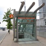
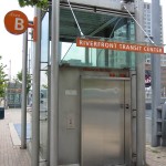
| Great American Ballpark Paul Brown Stadium National Underground Railroad Freedom Center Central Riverfront Park West 2nd Street at Vine Street, Cincinnati, Ohio The Riverfront station consists of Blue Line trains running east-west via the Riverfront Transit Center, and Orange and Gold Line trains crossing in a north-south direction in a deep-bore station below. This lower station consists of two side platforms, connected to the Blue Line platforms via escalators and elevators.
South of the Riverfront station, the Orange Line crosses under the Ohio River via a deep-bore tunnel into downtown Covington, Kentucky. This river crossing is approximately 200 feet west of the historic Roebling Suspension Bridge. |
||||||||||||
| Ohio River Crossing via tunnel |
||||||||||||
| Roebling Bridge | ||||||||||||
| Downtown Covington Scott Street at East Third Street, Covington, Kentucky Prior to entering this station, the Gold Line diverges onto a parallel express track. Both lines serve an island platform at the Roebling Bridge station, while northbound Gold Line and Orange Line trains merge onto a single track south of the station, and serve a single side platform. Fare control is on mezzanine levels above either end of the platforms, with access to the street level provided via ground-level pavilions. Leaving the station southbound, the line widens to four tracks and continues south under Scott Street, before turning southwest at Pike Street and following Pike Street toward Interstate 71/75. Gold Line trains run on the outer express tracks and skip the Pike Street and 12th Street station, while Orange Line trains running on the inner tracks and serve all stations. South of the 12th Street station, all four tracks emerge in the median of Interstate 71/75. The Gold Line express tracks merge with the Silver Line tracks from Union Terminal. The tracks and the expressway ascend a two-mile, 3.5% grade through the so-called “Cut in the Hill”. Gold Line and Silver Line trains bypass the Fort Wright station, which is served by the Orange Line. |
||||||||||||
| Fort Mitchell |
||||||||||||
| Interstate 71/75 and Buttermilk Pike, Fort Mitchell, Kentucky
This station consists of two island platforms in the Interstate 71/75 expressway median at the Buttermilk Pike interchange. One platform serves all outbound trains; other platform serves all inbound trains. Silver Line and Gold Line trains operate on outer express tracks; Orange Line trains operate on inner local tracks. This is the final station before the Silver Line and Gold Line split from the Orange Line and head west toward the airport. Orange Line trains continue southwest to Florence. This station would be a major hub for local bus routes, and include a large parking garage for Park-and-Ride commuter service. Upon leaving this station, Silver Line and Gold Line trains branch to the west along Interstate 275, running in the median of I-275 for approximately three miles before going into a subway tunnel between Mineola Pike and Point Pleasant Road. The tunnel enters the airport property in the vicinity of Point Pleasant Road and Commonwealth Avenue, runs under the northern end of the east runway, and heads west toward Terminal Drive. |
||||||||||||
| International Airport | ||||||||||||
| Greater Cincinnati – Northern Kentucky International Airport Terminal Drive at Terminal 3, Boone County, Kentucky This is a subway station with two island platforms, located below Terminal Drive in front of Terminal 3, the airport’s newest and largest terminal. One platform serves Silver Line trains; other platform serves Gold Line. Direct indoor connection to lower level of Terminal 3 and parking garage. Direct indoor access is provided to the lower level of Terminal 3 and to the Terminal 3 parking garage via an underground concourse. Above-ground walkways currently provide access between Terminal 3 and the other two terminal facilities at the airport. The station is designed so that a future westward extension of the transit line can be achieved with minimal disruption. |
Notes / Image Credits
- Ronny Salerno, “Cincinnati’s Other Abandoned Subway,†Queen City Discovery, http://queencitydiscovery.blogspot.com/2009/05/cincinnatis-other-abandoned-subway.html [accessed 9 August 2009].


